
Scotland Maps
Whole of Ireland
( Page 1 of 3 )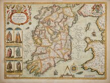
John Speed 1676
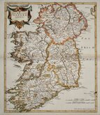
Robert Morden 1695

Pieter van der Aa 1729
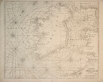
Mount & Page 1756
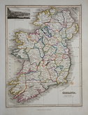
Thomson 1820
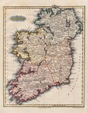
James Wyld 1824
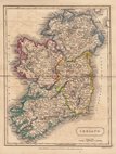
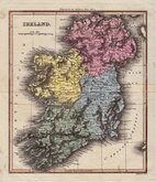
Sidney Hall 1826
Conrad Malte-Brun 1828


52x40 cm
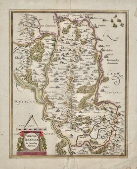
DECORATIVE MAP WITH INSET VIGNETTES OF IRISH PEOPLES
THE KINGDOME OF IRELAND
Devided into severall Provinces, and thé againe devided into Counties. Newly described.
John Speed (1552-1629), born in Cheshire, was a Tailor, becoming a member of the Worshipful Company of Merchant Taylors in 1580. He became interested in History and antiquities and became a member of the Society of Antiquaries and friend of William Camden. In 1611 he published his History of Great Britaine followed by his Theatre of the Empire of Great Britaine the following year. The Theatre was designed as the topographical section to his History and the inclusion of county maps with inset town plans has ensured Speed's name will be remembered. The maps were designed and engraved by Jodocus Hondius in Amsterdam from materials and instructions sent to him by Speed. Speed's main cartographical contribution was the town plans, Speed claiming authorship to those that include a scale of paces "by mine owne travails". The county maps are based on the surveys of Christopher Saxton and John Norden. The inclusion of the internal administrative divisions of the counties was a new innovation by Speed perpetuated in most county maps that followed for the next 300 years. The descriptive text on the back of the maps is taken from Camden and as the text had to be re-set for each issue enables us to date an individual map. On 29th April 1608 George Humble obtained the rights to print and sell the atlas for 21 years but publication did not actually start until 1612 (title page dated 1611). Publication of John Speed's maps continued by various publishers until at least 1770, a publication period of 160 years.
The map of Ireland, one of the most decorative maps of the country, beautifully engraved by Jodocus Hondius with a depiction of Irish peoples; Gentleman and Gentlewoman, 'Civill' man and woman and 'Wilde' Irish man and woman, was first published in the fourth book of John Speed's Theatre of the Empire of Great Britaine in 1612.
This example, from the 1676 edition published by Thomas Bassett and Richard Chiswell with English text verso, is showing signs of wear with much of the sea hatchuring lost but otherwise it is a good impression with minimal wear to the main areas of the map or decorative features.
Some light additional creasing. Good margins all round with only a few slight nicks to edges all but one, at top centre (now repaired with archival tape verso), well clear of printed area. The map remains a very good example in good later hand colour.
Quick Links


Whole of Britain & British Isles
Parts of Ireland & Counties
×