
Essex Maps
Suffolk Maps
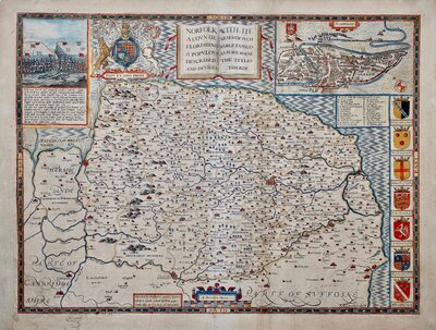
( Page 1 of 4 )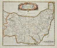
Robert Morden 1695 [1722]
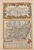
Emanuel Bowen 1720
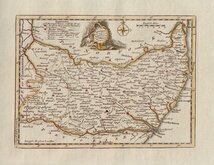
Thomas Kitchin 1748 [c.1786]
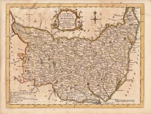
Thomas Kitchin 1764
Thomas Conder 1784
John Haywood 1791
Robert Butters 1803
John Cary 1808 [1809]


42x36 cm
FIRST COUNTY MAP TO SHOW LONGITUDE FROM LONDON AND LOCAL TIME
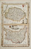
SUFFOLK
by Rob.t Morden
Sold by { Abel Swale Awnsham & Iohn Churchil
Copper engraving produced by Robert Morden (fl.1669-1703) for publication in Edmund Gibson's translation of William Camden's Britannia first published by Abel Swalle and Awnsham & John Churchill in 1695. Engravers Sutton Nichols and John Sturt have signed some of the maps but probably other engravers were also employed.
This is the first series of maps to mark longitude in minutes of time (top border) as well as in degrees (bottom border). For most counties longitude is based on the meridian of St. Paul's, London. They were the first folio sized series of county maps to show roads, Morden using the survey and strip road maps of John Ogilby (published in his road book, also entitled Britannia, in 1675). Morden's miniature maps produced on a set of playing cards in 1676, shortly after Ogilby’s production, were the first complete set of county maps to include roads. Morden did not use Ogilby's measure for the mile of 1760 yards which later became the accepted standard, but used a somewhat arbitrary approximation of local variations for the mile to include three scales, 'Great', 'Middle' and 'Small' miles on his maps.
The work was republished in 1722, 1730, 1753 and, finally in 1772. There were a number of minor alterations to most plates during the early editions and they were substantially updated for the 1722 edition mostly with changes to place name spellings. Due to wear caused by the printing process the plates were reworked for the 1753 edition.
Good example in later and colour from the 1722 edition.
Quick Links


Cambridgeshire Maps
Norfolk Maps
×