
Mediterranean
Sea Charts
( Page 1 of 3 )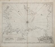
Irish Sea Isle of Man 1688 [c.1693]
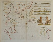
Orkney 1693
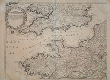
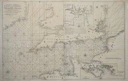
English Channel by Petrini 1715
Bay of Toulon 1739
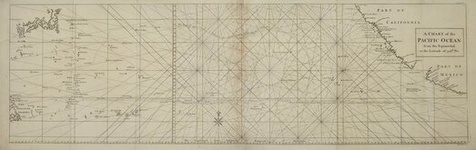
Pacific Ocean by Anson 1748
English Channel 1753
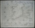
Burnham Flamborough Head Berwick 1755
Mount & Page 1756


56x45 cm
To the Honble. SR. IOHN LOWTHER Bar.t One of the Commissiners for Executing the Office of Lord Highe Admirall of England. 1688
Sea chart showing the Irish Sea with the coasts of North Wales and Anglesey, Lancashire, Cumberland and Scotland, with the Isle of Man.
North is to the right.
Insets of coastal features; 'Thus sheweth Great and Little Orme's head when you go over the best of Chester Barr' and 'Thus sheweth the 3 Hills when you are on the shoal est of Chester barr, the 3 Hills bear S.o
First published in Great Britains Coasting Pilot... By Captain Greenvile Collins...in 1693, the work was re-issued several times until 1785 and was a landmark in the charting of the seas around Britain, being the first English Pilot Book of the whole of the coasts of Britain.
Some light spotting and some nibbles, thinning and short tears to the paper edges with some archival tape strengthening within margins verso. Good margins all round.
Quick Links

Map Books
Maritime
×