
Town Plans
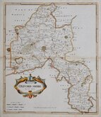
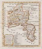
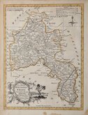
Oxfordshire Maps
( Page 1 of 3 )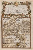
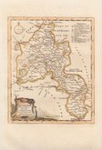
Emanuel Bowen 1720
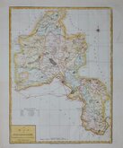
Robert Morden 1722
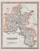
Emanuel Bowen 1758
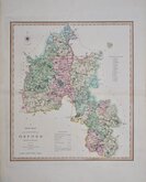
Thomas Kitchin 1763
Thomas Kitchin 1769
John Haywood 1791
Benjamin Baker 1793
Charles Smith 1801


12x18 cm
A MAP of | OXFORD | SHIRE
Map set below a decorative cartouche containing the title and details of the road from Bristol to Banbury.
Road map of the second part of the route from Colchester to Great Yarmouth verso.
Engraved text descriptions alongside the county map and alongside and below the road map.
Engraved by Emanuel Bowen (1693?-1767) and published in the pocket road book Britannia Depicta by Thomas Bowles from 1720 to 1764. The county maps were based on Robert Morden's small series published in The New Description and State of England... from 1701. Text descriptions compiled by John Owen.
Fine early example.
For full description of the road, go to category: Maps > British Isles > RoadMaps > Owen & Bowen.
Quick Links

Buckinghamshire Maps

Berkshire Maps
×